By Donald H. Harrison
SKAGWAY, Alaska –The narrow-gauge railroad that climbs from this town 20.4 miles to the Canadian border at White Pass, and then some 90 miles farther north up to the Yukon territorial capital of Whitehorse, is given the same sort of respect by civil engineers that they accord to such marvels as the Eiffel Tower, the Statue of Liberty and the Panama Canal. The railroad was designated as an International Historic Civil Engineering Landmark in 1994.
The onboard magazine, All Aboard, explains that the White Pass and Yukon Route Railroad was so honored because of the “many difficult and hazardous obstacles that construction overcame: design challenges, granite mountains, steep grades, cliff hanging turns and unimaginable weather conditions.”
But don’t get the idea that Alaskans or Canadians bedeck themselves in blue ribbons, or put their noses in the air and sniff when discussing less demanding engineering projects—unless, perhaps, if you’re talking about the Klondike Highway, which at certain points runs a nearly parallel course as the railroad in Alaska.
Noting a bus stopped on an apron of the highway across a wide mountain gulch, our guide on the train commented, with pretend contempt, “You might be wondering if you chose the right tour from Skagway today. Well, I will tell you one thing: I have never seen a train stop to take a picture of a bus.”
Humor rides along with you on the tracks that first started taking gold prospectors to the Yukon Territory back in 1900 – after a two year, two month and two day construction project that at its zenith employed 35,000 men during the late 1890s.
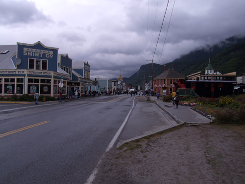
Serving as the port for the would-be gold discoverers, Skagway was incorporated in 1900 as Alaska’s first city, soon to be followed by Juneau. Not all the people who came to Skagway (a name derived from the Tlingit language for “the place where the North Wind blows”) were intent on traveling closer to the North Wind’s source to find gold. Some decided they could fleece the prospectors before they ever left Skagway.
During the time of the 1898 Gold Rush, the Canadian government decided that it had to protect gold-happy prospectors from freezing or starving to death in the Yukon. It required them to carry approximately two tons of supplies to sustain themselves. To get that many supplies across the Canadian border – after a long trek along either the White Pass Trail or the steeper but shorter Chilcoot Trail –prospectors in the days before the railroad had to carry their loads in stages.
Scam artists in Skagway capitalized on this. One scheme involved selling “special” bicycles to naïve travelers. The bikes had large side baskets, supposedly capable of carrying all the supplies. It would be all but impossible to bicycle along either route, much less to carry heavy supplies on the bike, our tour guide pointed out.
But that was not the only scam—not by far. Another one involved selling to the prospectors “gold-sniffing gophers” which allegedly had been trained to run to the gold fields and bring back the nuggets. Those were the first “golden retrievers” in Alaska, the guide joked. And history should not forget another way that prospectors were exploited. They were told if they purchased a certain lotion, and rubbed it over their bodies, and then rolled around on the ground, all the gold dust in the area would attach itself to them.
There were a lot of villains in those gold rush days, and according to our tour guide, one Jefferson R. Smith, more commonly known as “Soapy Smith,” was a notorious conman. “When the town discovered all his wrongdoings, they were not happy about it,” according to what I assume was a script that the guide was sharing with us over the train’s loudspeaker. Skagway’s leaders held a town meeting to decide just what to do about Soapy, but before the meeting concluded, he appeared with his gun loaded. A man named Frank Green faced him in a duel, and after both men fired, Soapy was dead. “Frank Green was not so lucky: he died an agonizing 12 days later after a gunshot wound to the groin. It is often said that he lost his gold nuggets that day.” Now the two of them are buried in Skagway’s cemetery just north of town.
Although Alaska’s spaces are vast, Skagway is only 22 blocks long by 4 blocks wide, meaning it doesn’t have a lot of space. Therefore, said the guide, “Skagway tends to be a pretty big fan of the all-in-one. We have an Italian restaurant in town that also serves Mexican and Greek food.” And the Radio Shack not only sells its own inventory, “they rent DVDs, sell clothing and have a tanning bed.”
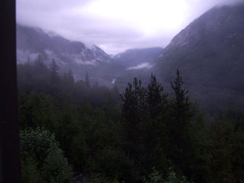
In addition to the light-hearted narrative, a roundtrip excursion to White Pass offers some dramatic scenery and some impressive history.
There’s a section near the 6.9 milepost where blasting powder during the construction of the railroad reportedly liberated a 10,000-ton chunk of granite, causing it to crash down the mountainside to the Skagway River, creating such a blockage that the river had to permanently change course.
And farther north, at milepost 10.4, there is another section marked by a 500-pound boulder painted with a black cross. Among the 35 people killed during the building of the railroad were two who were at that very site when the boulder crashed down upon them. The boulder was too large to move off them, so it was painted with the cross and became their permanent grave. According to the narrative, Michael J. Heney, then president of the railroad, remarked that no railroad worker could expect a finer monument than that.
Little more than a mile from the black cross is Bridal Veil Falls “which tumbles 5,000 feet to the valley floor in 33 cataracts,” our guide told
us. Its source is a glacier much higher up in the mountains.
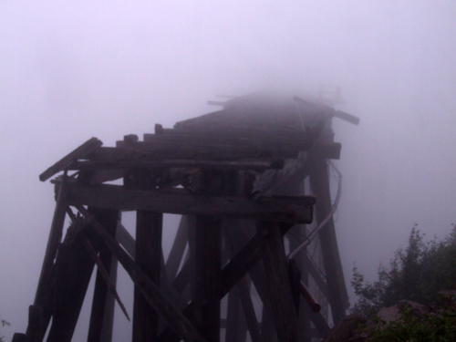
A three-mile horseshoe shape curved track brings the train over three bridges, including one wooden trestle that looks down on a 1,000-foot drop. Our guide cheerily advised us: “If you don’t like heights, this would be an excellent time to admire the upholstery we have on the seats of our train cars.” One abandoned bridge in the fog seemed to be a passage to eternity.
Before the railroad was built, when thousands of prospectors “stampeded” to the Yukon gold fields, the pathway near milepost 19.3 was so narrow that at times all the stampeders had to go single-file. “If they stepped out of line for just a moment to readjust a pack or tie a shoe, it could take them 2-3 hours just to find their way back into line.”
The U.S. Customs House is set miles back from the border separating Alaska from British Columbia in this region—the reason being that the terrain at the border is too rugged and the weather too wild and unpredictable to provide U.S. Customs agents a reliable and safe base.
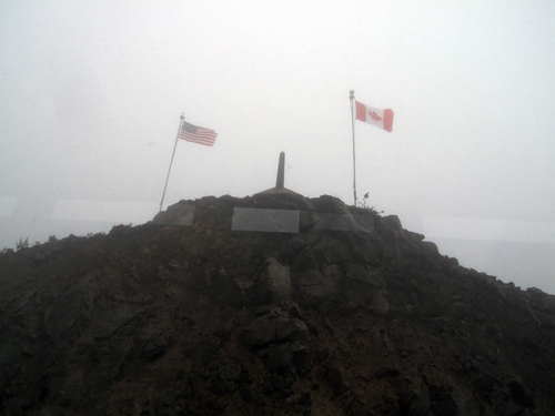
The border is marked by an obelisk flanked by the flags of the United States and Canada. Not far from there five flags fly: those of the United States, Alaska, British Columbia, Yukon Territory and Canada – the five jurisdictions served by the White Pass & Yukon Route railroad.
*
Harrison is editor of San Diego Jewish World. He may be contacted at donald.harrison@sdjewishworld.com File: US Canada West 17