Editor’s Note: This is the 24th in a series of stories researched during Don and Nancy Harrison’s 50th Wedding Anniversary cruise from Sydney, Australia, to San Diego. Previous installments of the series, which runs every Thursday, may be found by tapping the number of the installment: 1, 2,3,4, 5, 6, 7,8, 9, 10, 11, 12,13, 14, 15, 16, 17, 18, 19, 20, 21, 22, 23.
By Donald H. Harrison
AT SEA, Aboard MS Maasdam – After leaving New Zealand en route to Tonga, French Polynesia, Hawaii, and San Diego, lecturers aboard our cruise ship acquainted us with interesting facts and perspectives about both the Pacific Ocean and the Polynesian Triangle.
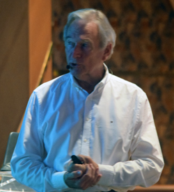
For example, lecturer Judson Croft urged passengers to look at a map of the Atlantic Ocean. At a certain distance from the earth, the ocean, South America, and Africa all fit into the viewing frame. But from the same distance, all one can see of the Pacific Ocean is water – because the Pacific Ocean, occupying one-third of the earth’s surface—is so much larger than the Atlantic, said Croft.
Croft, who spent a career as an electronics technologist working with shipboard systems, has had a life-long affinity for learning whatever he can about oceans and ships. That knowledge, built up over decades as a sailor and explorer, landed him a position with Holland America as a guest lecturer. Born in California, he immigrated to New Zealand as a young man, and has a special fondness for the waters and lands of the South Pacific.
 The lecturer pointed out that if one doesn’t already live along the Pacific Ocean, reaching it by water from other oceans can be quite difficult for those who don’t use the Panama Canal. One way of access is via the Bering Strait, “and that is not a nice journey,” said Croft. “If you are coming from the southwest, the only way you are going to get in will be north of Australia via Cape North. That’s doable, but it’s not a piece of cake. If we move over to the other side of the ocean, the only way is through Cape Horn,” famous for its rough seas at the bottom tip of South America.
He noted that Hawaii sits at the northern point of the Polynesian triangle; New Zealand at its south, and Easter Island—so named because Dutch explorers “discovered” it on Easter Sunday—sits on the east.
Soon after Croft spoke, the Maasdam’s captain Arno Jutten came over the ship’s public address system to report that at noon time we were “currently steering a northeasterly course in the part of the South Pacific Ocean that is called the South Fiji Basin. We will continue on this heading all the way to the Tonga Islands Group.” Our next port of Nuku’alofa, Tonga, was 728 nautical miles distant, he said. The depth of the water where we were cruising was over 12,000 feet.

David Happe, Maasdam’s excursions guide, picked up the narrative a little later in the day. He said that Polynesia occupies nearly half of the Pacific Ocean, and that languages throughout Polynesia are similar. “The words in Hawaiian compared to Maori (in New Zealand) is about 75 percent similarity, and Tahiti is more than that.”
Various theories have been advanced concerning how the Polynesian islands became populated. Many believe that the Polynesian people had their genesis on the island of Formosa, today known as Taiwan, off the coast of mainland China. From there people came “down to the Philippines and eventually over thousands of years spread out along the entire South Pacific,” said Happe. On the other hand, the Norwegian explorer and ethnographer Thor Heyerdahl suggested that the Polynesians actually had their origins in the Americas, Happe reported.
The excursion guide said it is believed that Tonga was one of the first Polynesian Islands to receive migrants, with settlement in Hawaii and New Zealand coming much later. Besides language, pottery provides a clue to the dispersion of the Polynesian people, Happe said. The prehistoric Lapita people are believed to be the common ancestors of the island peoples not only of Polynesia, but also of Melanesia and Micronesia, he said. Lapita pottery has been dug up by archaeologists throughout the Pacific.
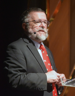
Later that afternoon, anthropologist Charles Urbanowicz, a retired professor from California State University at Chico, said that Polynesian ancestors may also have migrated via land bridges that had been caused centuries before by “the last glaciation, 10,000 years ago.” These land bridges “connected Southeast Asia, and New Guinea to Tasmania.”
When Polynesians traveled by large outrigger canoes, or wakas, they were a sight to behold, Urbanowicz said. “They could sail circles around the European vessels of the day.”
While the lectures in Maasdam’s Showroom of the Sea intentionally did not have the rigors of an academic classroom – and there were no tests — they were both entertaining and informative. Two and sometimes three of the speakers shared their insights with us during days at sea. The portion of our cruise from Auckland, New Zealand, to San Diego, California, required 25 days, including port stops. With that much ocean around us, it was nice to have new facts to contemplate.
*
Harrison is editor of San Diego Jewish World. He may be contacted via donald.harrison@sdjewishworld.com
Pingback: Tonga’s love for the Jews of the Bible | San Diego Jewish World